Future use of land at Shotwick Park
Background
In November 2024, Cheshire West and Chester Council took the decision to retain the land at Shotwick Park. The Council is now exploring ways to help ensure that the site reflects the needs and aspirations of local people and protects the historic and ecological assets of the site, whilst attracting enough external funding, grants and other income to sustain the management of this land into the future.
Shotwick Park is an area of 150 hectares of land comprising of pasture, woodland, arable land and an area of historic parkland. The land is located in Saughall, to the north-west of Seahill Road and Church Road and south of the A494. There is land either side of Lodge Lane, with the majority lying south of the lane. It does not include a section of land in the middle of this area, where the Shotwick Castle ancient monument is located.
Your feedback so far
In early 2025 we asked for community feedback on a vision for Shotwick Park, that would see the establishment of woodland and habitat creation, transforming the site for the benefit of the local community and environment.
Alongside support for the vision, we received valuable feedback on the importance of protecting and enhancing current features of the site, the benefits it would bring to the community, and a range of ideas and considerations for the plans. You can read the engagement findings report on the Council's Participate Now website.
Draft designs
In response to the feedback received, we have developed draft plans for Shotwick Park which can be viewed on the Council’s Participate Now site (see link below). Details about the engagement has also been shared through the Parish Council’s communication channels.
The local community can share views on the detailed designs, to ensure that the plans enhance the site for the benefit of local people, nature and the climate. Click on the link below for details.
Map of Shotwick Park
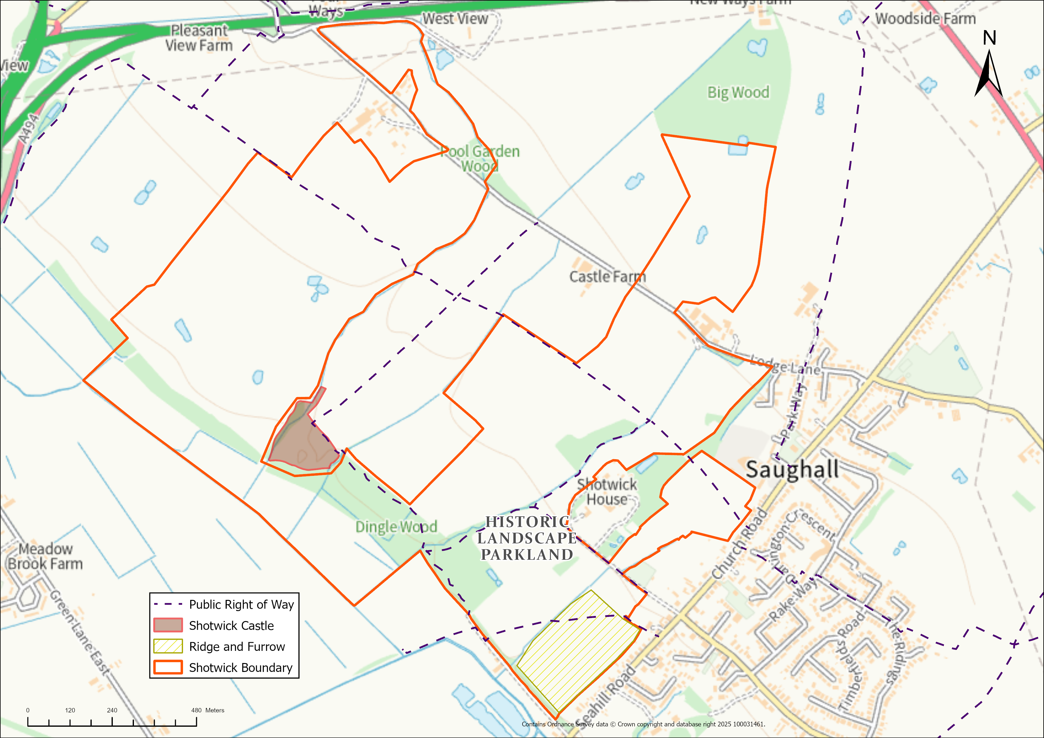

Shotwick Park is an area of 150 hectares of land comprising of pasture, woodland, arable land and an area of historic parkland. The land is located in Saughall, to the north-west of Seahill Road and Church Road and south of the A494. There is land either side of Lodge Lane, with the majority lying south of the lane. It does not include a section of land in the middle of this area, where the Shotwick Castle ancient monument is located.
For any further queries, please email via: