3.3 Street typologies
Street Typologies
- Type 1: Principal Streetsopens new window
- Type 2.A: Primary Residential Streetsopens new window
- Type 2.B: Secondary Residential Streetsopens new window
- Type 3: Tertiary Residential Streetsopens new window
- Type 4: Industrial Roadsopens new window
Street types provide a framework for balancing place and movement within a connected network. Establishing a clear street hierarchy helps ensure streets are designed according to their role, context and function, creating places that are legible, connected, safe and responsive to the needs of communities.
This is a pattern book of street types that can be applied to new developments, speeding up the design and planning process. Each type has set characteristics such as width, setbacks, materials, etc. Good placemaking principles are ‘baked in’ to each. The streets are categorised by their function in terms of both movement (low traffic to high traffic) and their place function (how they are used by people).
Street typologies should be selected according to their role within the wider movement network. Before designing individual streets, applicants should refer to the guidance below to determine the appropriate street hierarchy and permitted street connections.
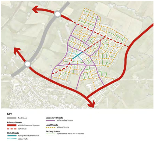
The choice of street type will largely depend on a street’s position within the wider network. For example, a primary street must always connect to other primary streets, or the trunk road network; Secondary streets should always connect from primary streets or high streets, and so on. Sites do not need to use all street hierarchy types and don't need to start at the top of the hierarchy.
Not all developments will feature every street type, but every street in a development must conform to a street type.
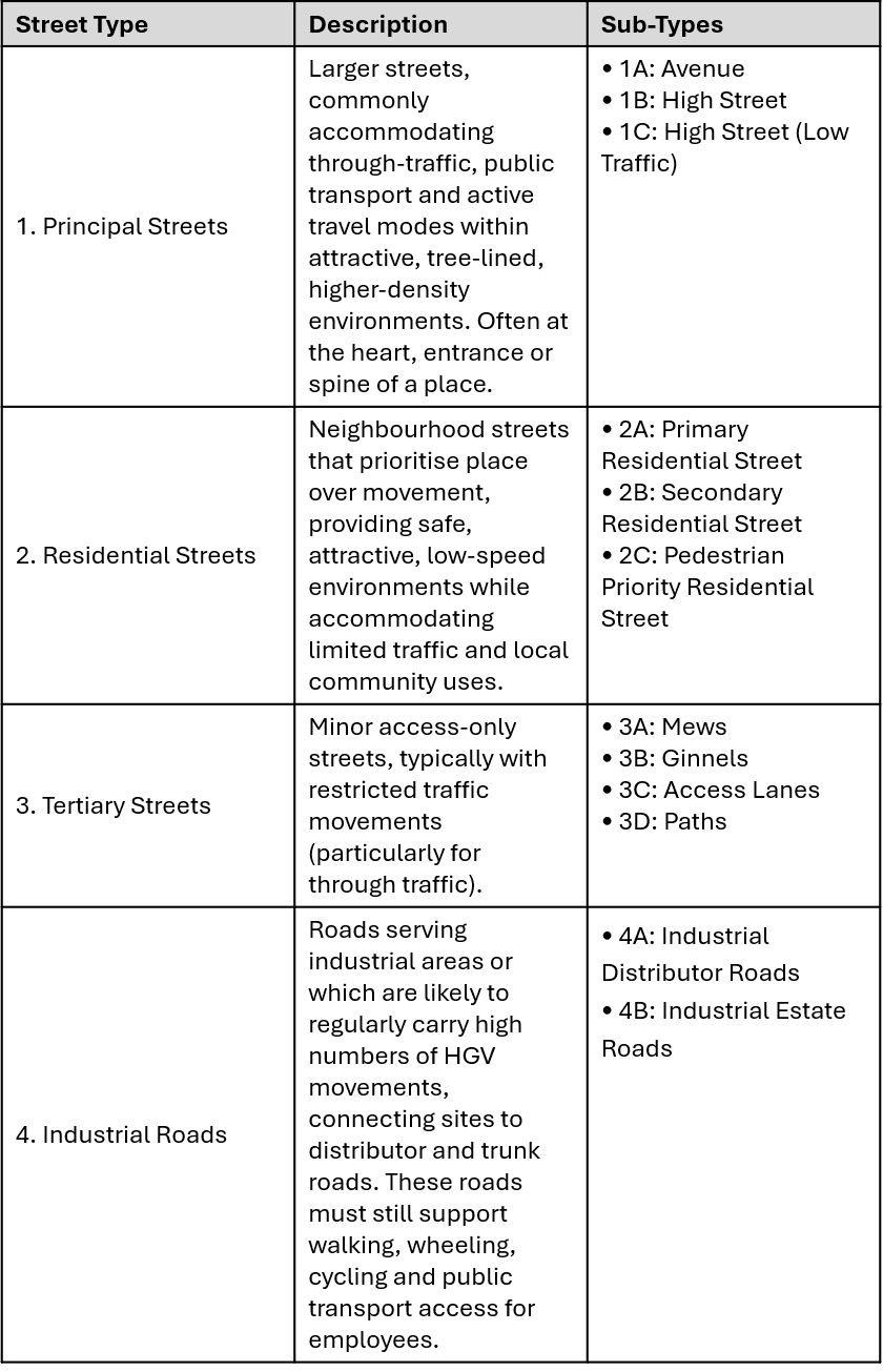
The four main typologies and their associated sub-types are shown in the table below.
Key Principles and using the Street Typologies
To align with the wider aims, principles, and vision of this Design Code, street design:
Street design must respond to the street's relative place and movement function, put people first through application of the user hierarchy set out in Manual for Streets 2, support permeability, connectivity and walkable neighbourhoods, reflect local character, context and activity, and deliver safe, inclusive, healthy and sustainable environments.
For all major residential developments, where new streets are proposed, developers must submit a street typology plan as part of the site's transport statement/assessment and design & access statement. Each street must be labelled in accordance with the Street Typologies below. Designs are not required to utilise all street typologies in their plan.
All new streets (whether proposed for adoption or not) must be in accordance with the Street Typologies. Any deviation from this will need to be agreed at the pre-planning stage, and will only be agreed in cases of bespoke, innovative design. Only the Street Typologies will typically be approved for adoption.
Type 1: Principal Streets
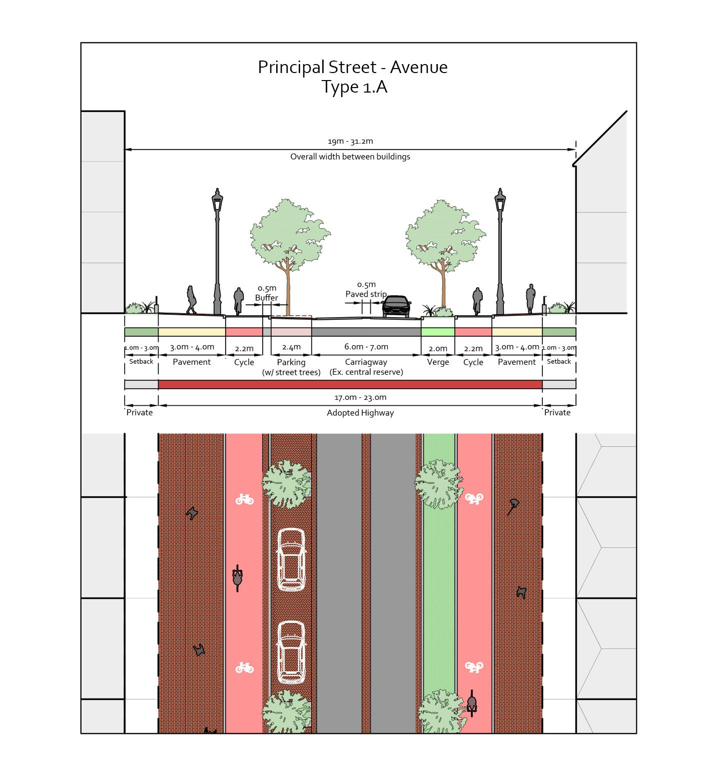
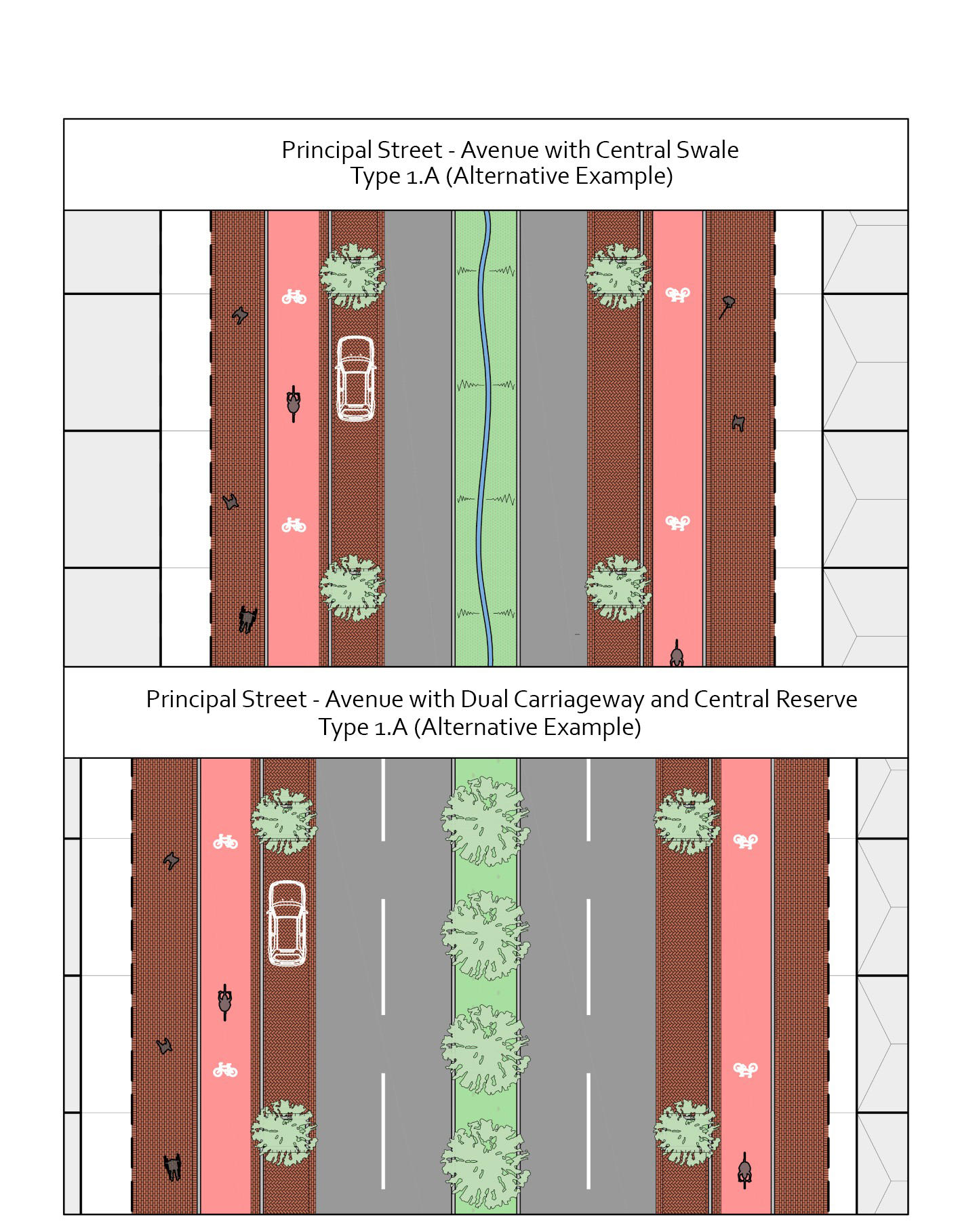
1.A Avenue
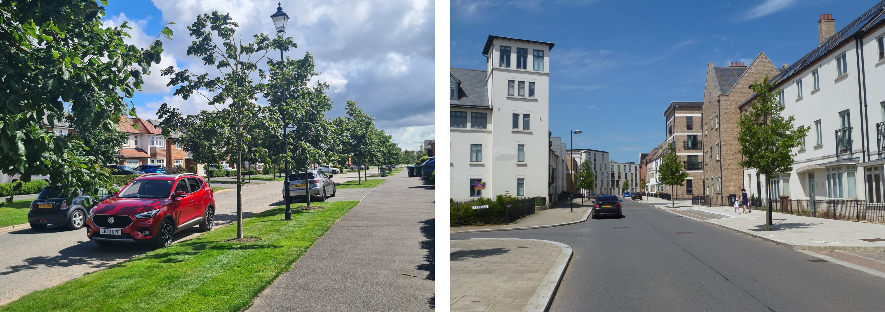
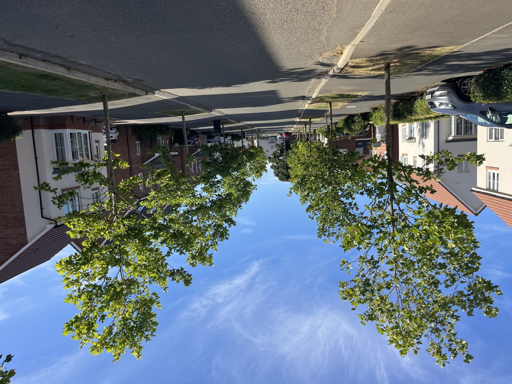
The highest order street in the network, these are arterials designed to take through traffic, with provision for public transport and segregated cycle lanes. They are wider, tree lined streets with taller buildings. However, they are not trunk roads and need to be designed as a balance of movement and place functions in line with the principles of this Design Code.
Type 1.B: High Streets - High Activity
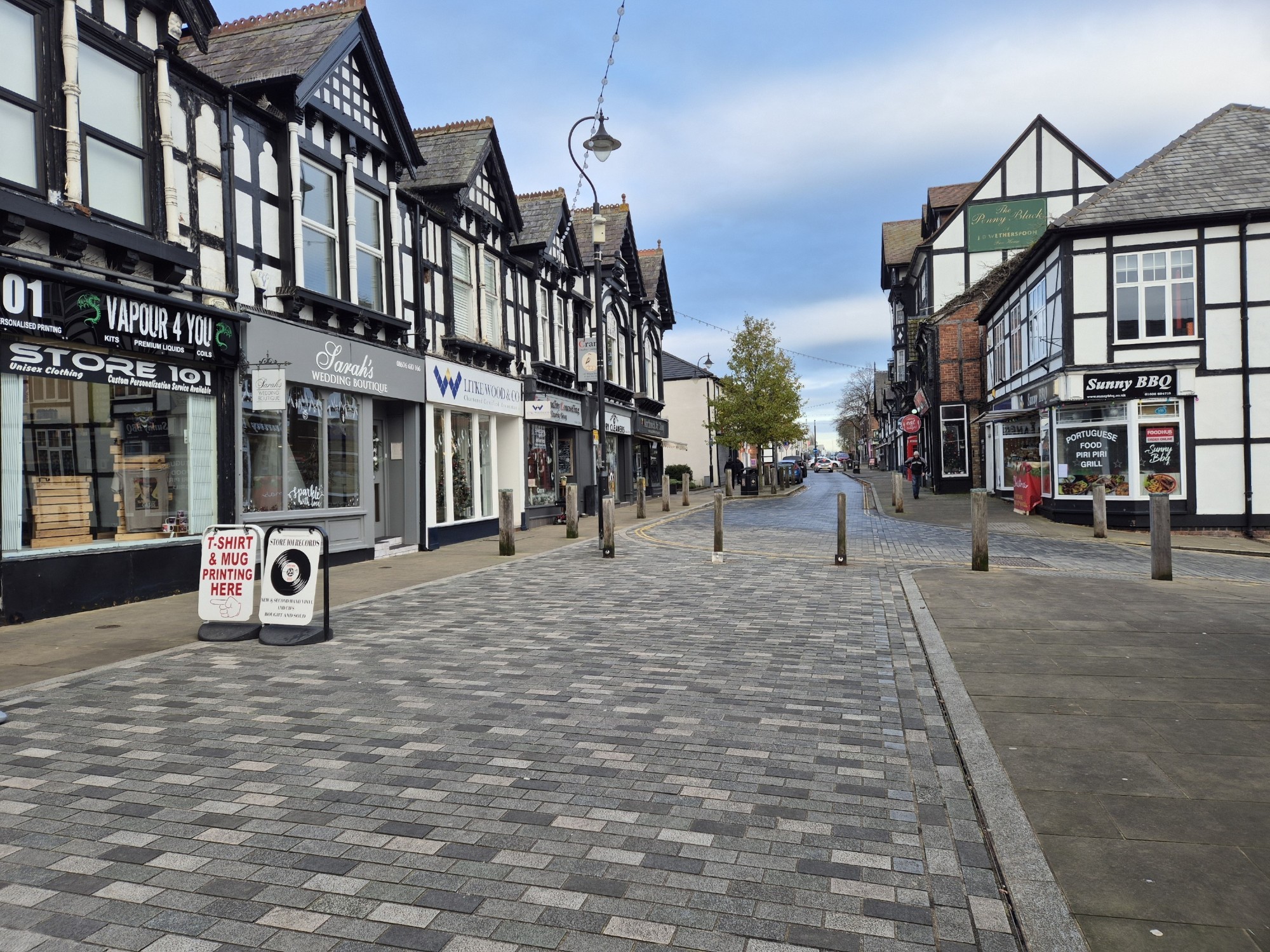
The main business street of a town, or the main hub of a new urban neighbourhood, normally with the highest density. These streets typically have shops and businesses on the ground floor with flats or offices above. They reflect traditional, town centre high streets, with through traffic, albeit at low speeds, and high levels of pedestrian movement.
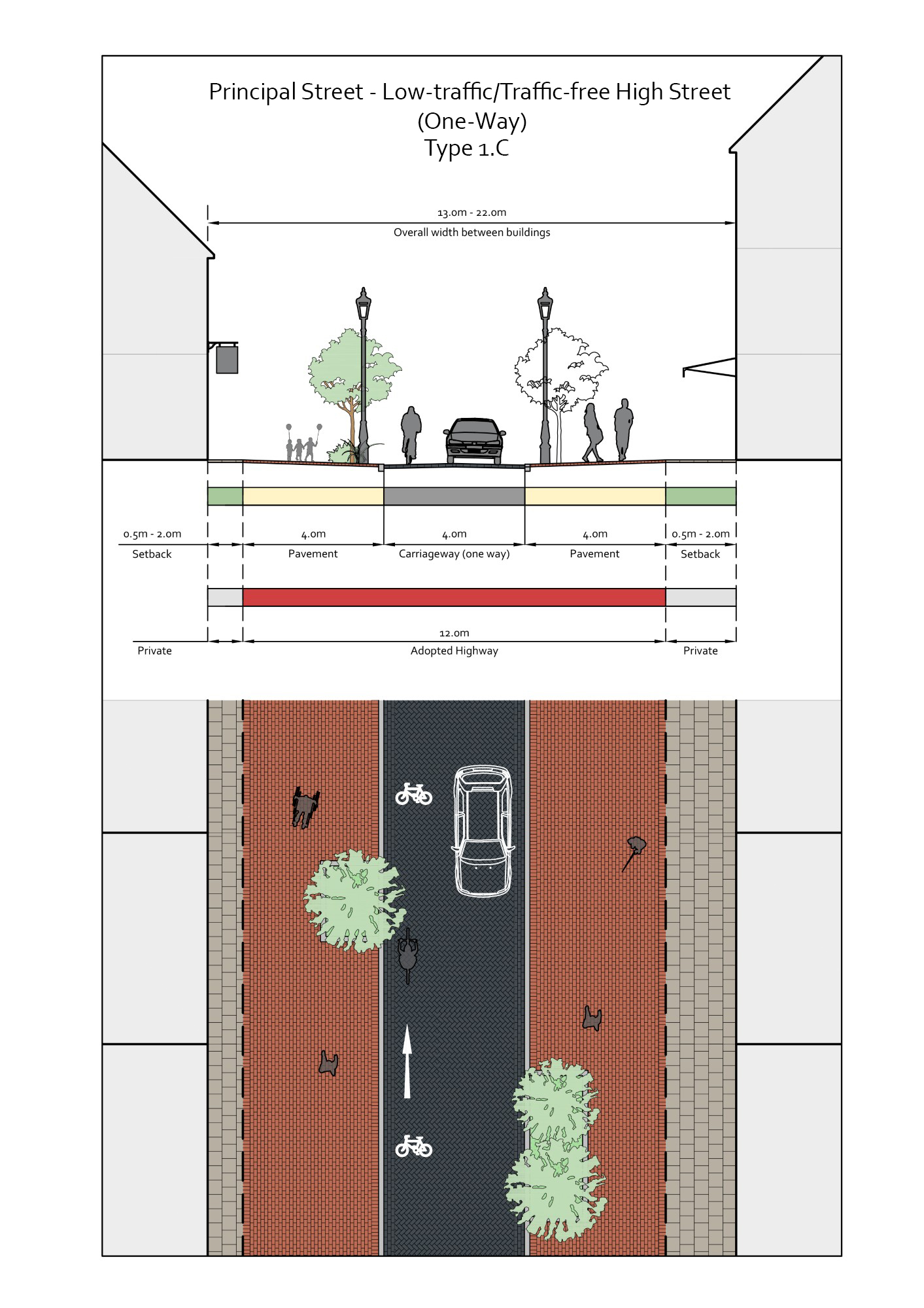
Type 1.C High Streets - Low Traffic/Traffic Free
A more informal typology, low traffic streets have similar characteristics to high streets but with greater opportunity to create squares and public spaces. The pedestrian or wheelchair user ’comes first’ in these streets. They do not have separate cycle lanes. Vehicles are a guest. This type of street can also be filtered or made traffic free, with only limited access for servicing.
Type 2: Residential Streets
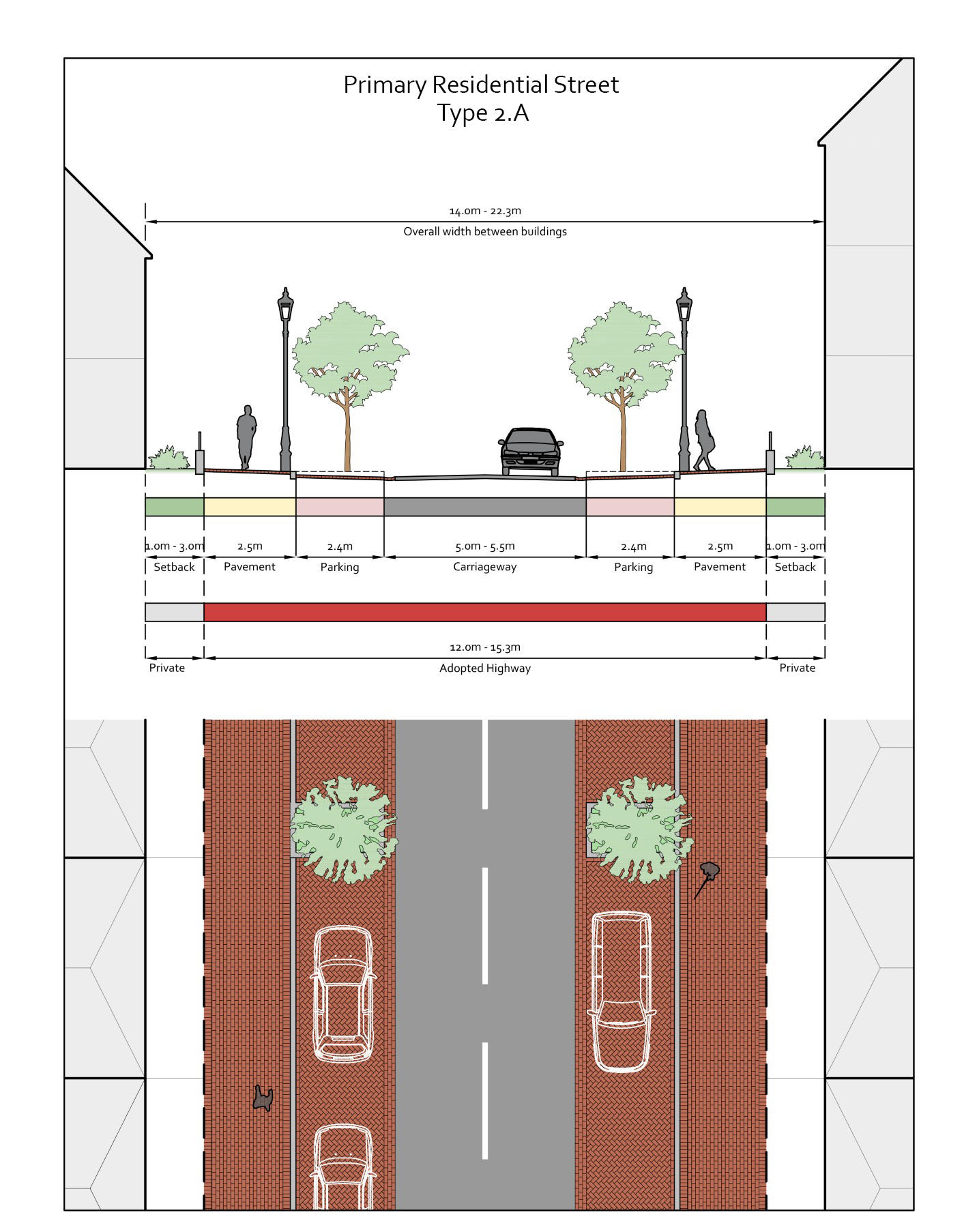
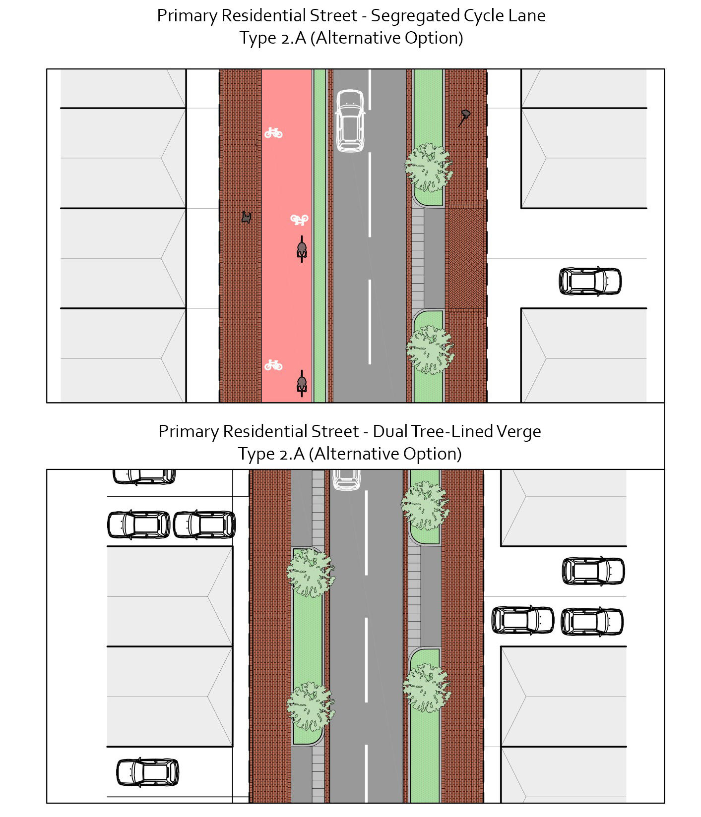
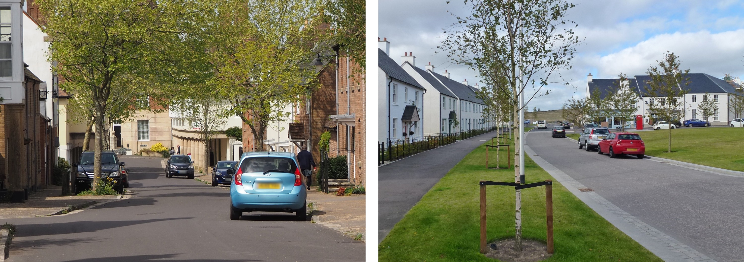
Type 2.A: Primary Residential Streets
These normally link to Primary Streets or High Streets and provide access to local streets and residential mews. Secondary streets can accommodate shops, cafes and community facilities. The design characteristics of the street prioritise 'place' over 'movement', through lower speeds, carriageway width, enclosure, and junction spacing. These connect Secondary Residential and Tertiary streets to Principal streets, and will have higher traffic flows
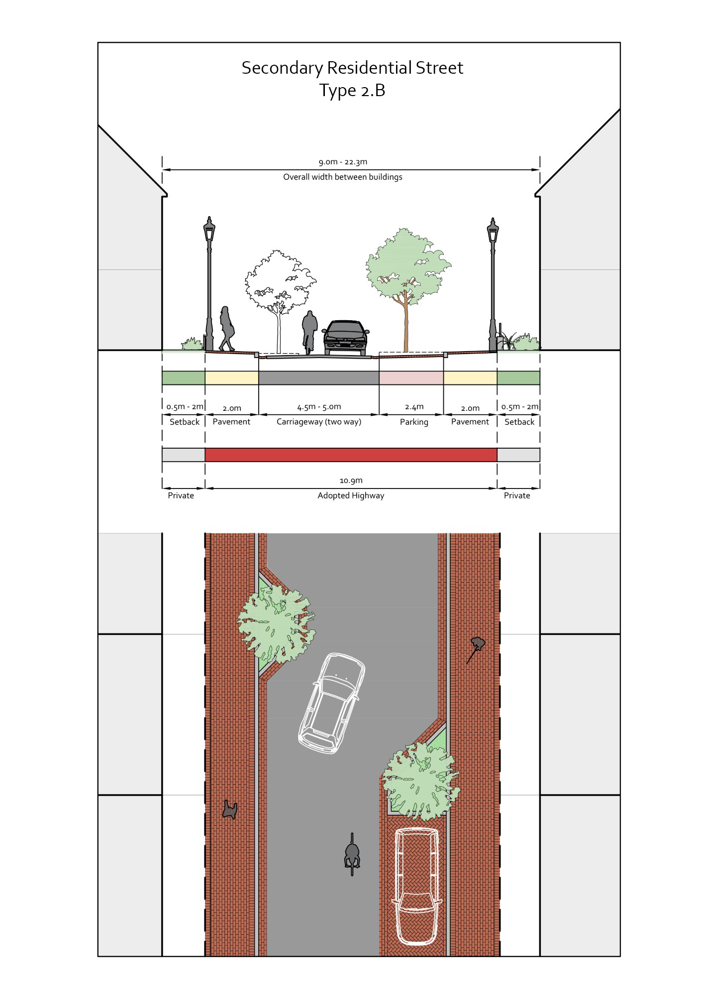
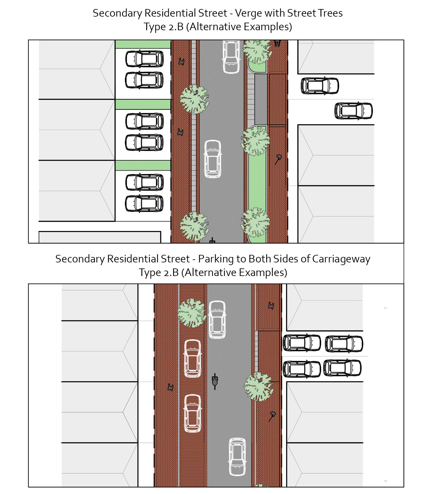
Type 2.B Secondary Residential
These will probably form most of the streets within the network for residential developments. These are attractive places to live and are safe and convenient places to walk, wheel and cycle, accommodating low levels of slow traffic. Filtering may be necessary to reduce through running on these streets while maintaining a conventional grid pattern with good connectivity.
Where existing trees within third-party land are located within 3m of the footway, root protection measures shall be provided along the rear edge of the footway to prevent future damage from root ingress and uplift.
These will not be subject to a prescribed standard tree pit specification as there are a range of tree pit systems available from multiple manufacturers, each offering solutions suited to different site conditions and design requirements. Tree pit designs should therefore be selected on a site-specific basis.
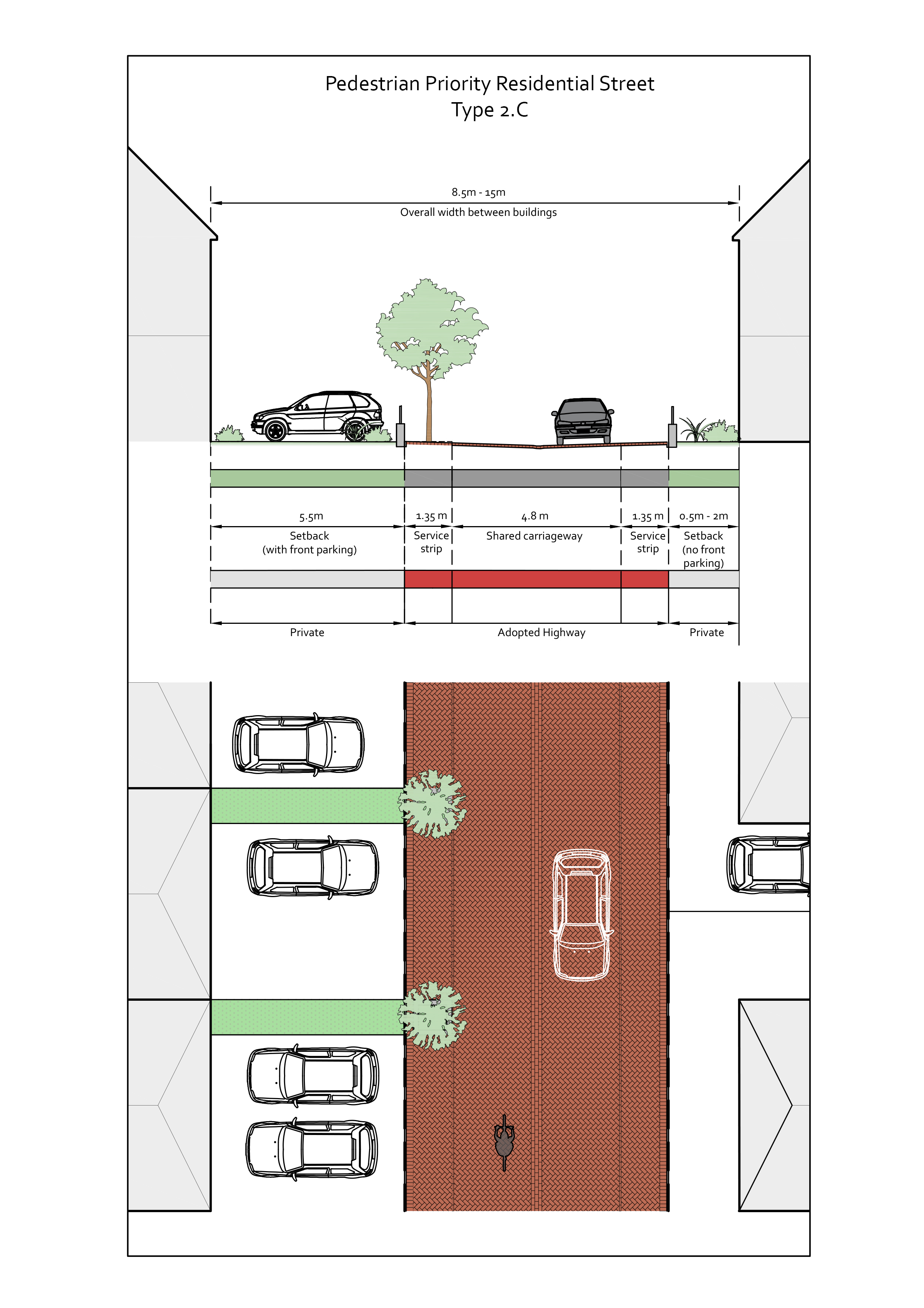
Type 2.C Pedestrian Priority Residential Street
These are residential streets where pedestrian movement and place-making take priority over vehicle movement. These streets are designed to be low-speed, low-traffic environments, typically incorporating shared surface principles, landscaping and high-quality materials to support social interaction, play, and active travel while maintaining essential vehicle access.
Type 3: Tertiary Residential Streets
Tertiary streets are the lowest order in the street hierarchy which accommodates vehicle traffic, typically with limited vehicle access. They are not suitable for adoption.
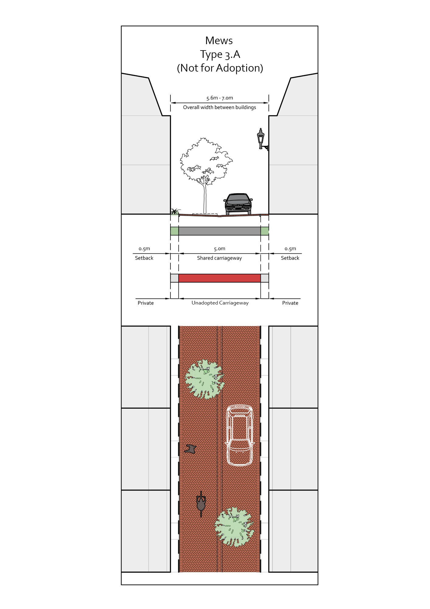
Type 3.A Residential Mews
The most common tertiary streets will be residential mews which are narrow residential streets lined by homes, often to the rear of large houses. They can provide a through route for walking and cycling, but this must be filtered to limit vehicle access. If on-street car parking is provided it should be in clearly delineated locations. The surface will be level, and shared, with no separate pavement.
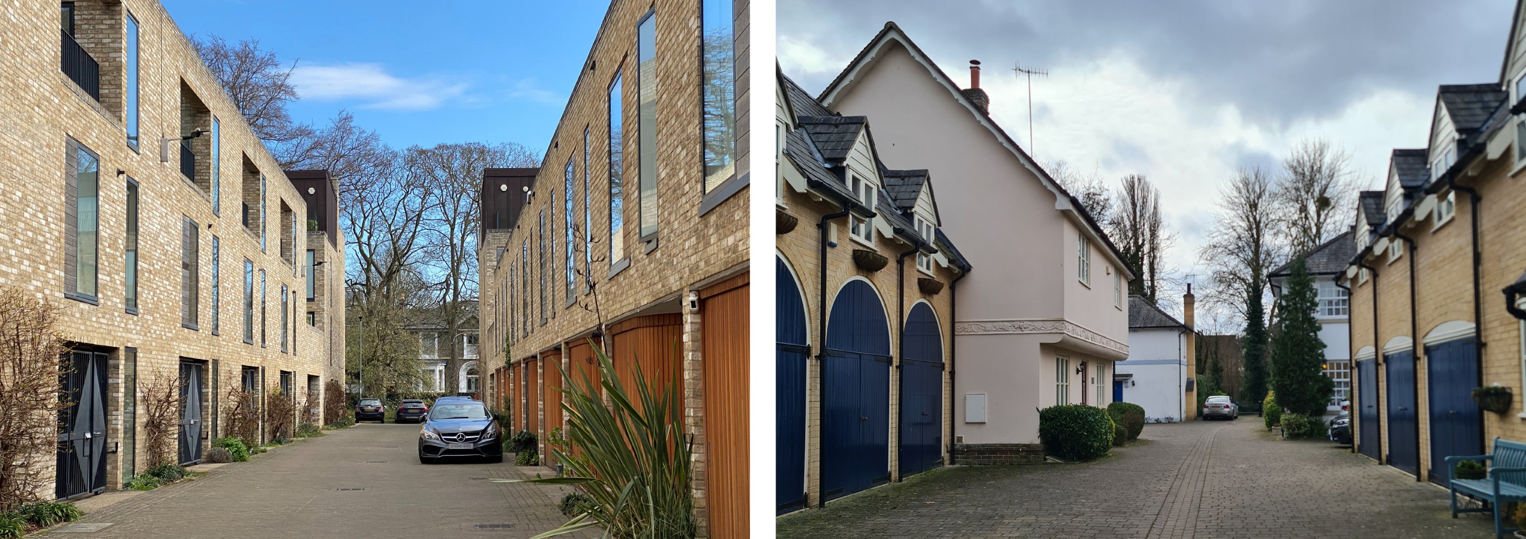
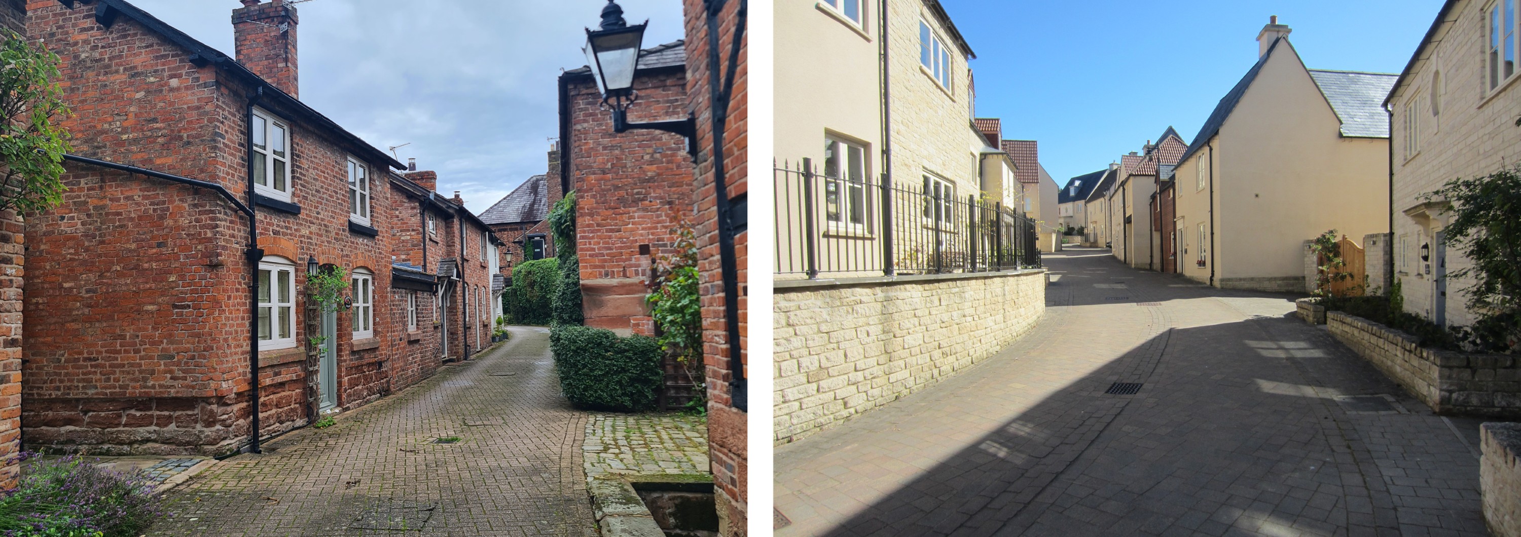
Type 3.B Ginells or Courts
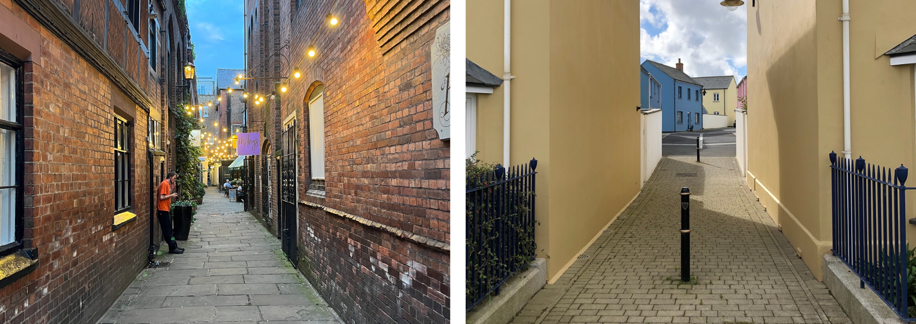
These are the narrowest streets in the hierarchy and must be traffic free, apart from emergency or limited servicing access if required. These streets, common in historic town centres, could be for access by foot, wheels or bike (ginnels) or function as a small commercial street and have shop frontages on one or both sides (court). A ginnel is a useful way of providing a pedestrian short cut through larger blocks. Any shared space would be required to have a servicing strip with boxes for lighting.
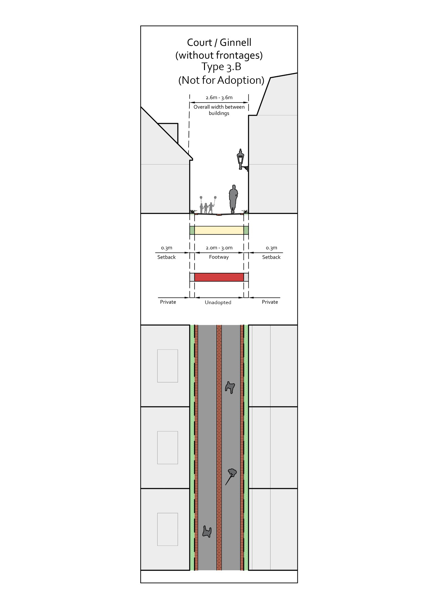
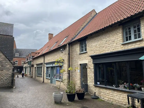
Ginnels or courts should be overlooked by homes or active frontages to allow passive surveillance or should be of a short length with a direct line of sight from one side to the other.
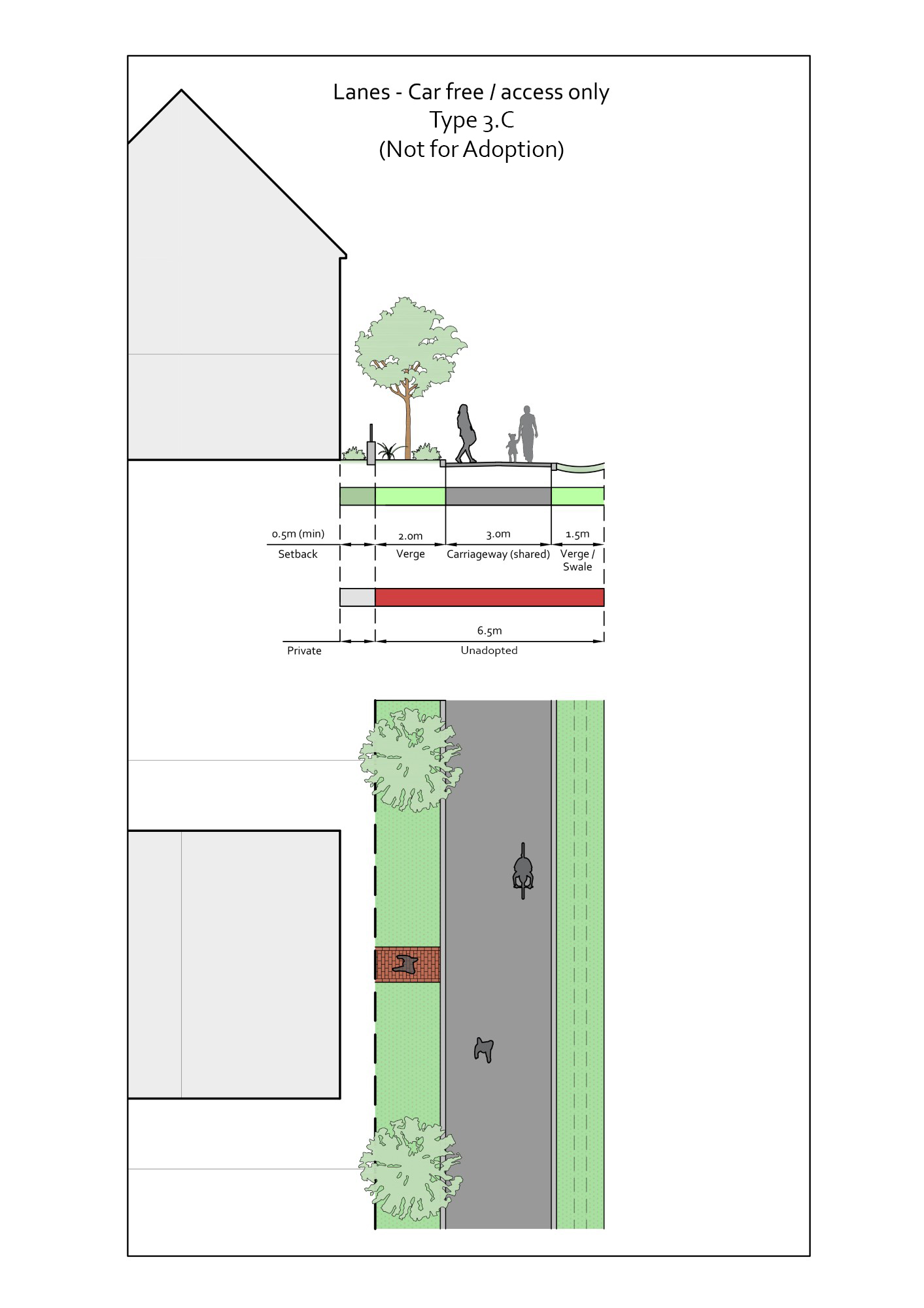
Type 3.C Access Lanes
Access Lanes are narrow streets that prioritise walking, cycling and access to homes and premises over vehicle movement. They are intended to serve a limited number of properties and should not function as through-routes for general traffic. As illustrated, these lanes provide a shared surface environment where pedestrian activity takes precedence and vehicle speeds, where vehicle through movement is permitted, are naturally constrained by the spatial form of the street.
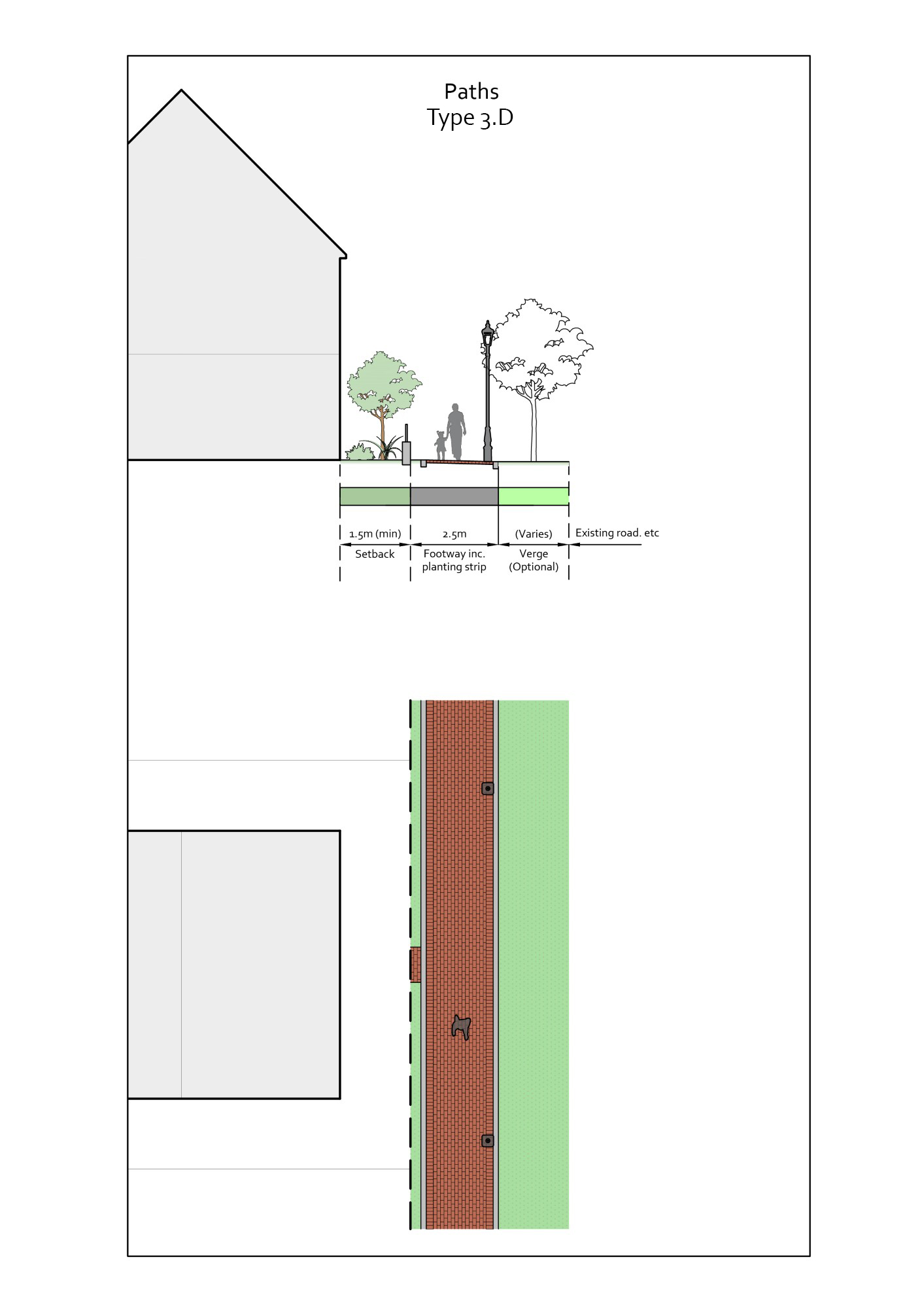
Type 3.D Paths
Paths are pedestrian and cycle only routes across green or open space, or providing access to properties where no direct vehicle access is required and where a normal street or access lane would be too wide, or undesirable. For example, where homes front onto a water feature or a park. They can be used alongside main roads, to allow buildings to front onto the street while maintaining some separation, as an alternative to conventional ‘access lanes’. When alongside main roads, they would ideally be separated by a 2m service margin that separates the main road from the footpath.
When new development fronts onto an existing street, parallel access roads must not be used. Instead, use a pedestrian only path and provide parking elsewhere.
Paths and cycle tracks should be designed to allow intervisibility from either end.
Paths and cycle tracks should allow occasional maintenance vehicle access.
Type 4: Industrial Roads
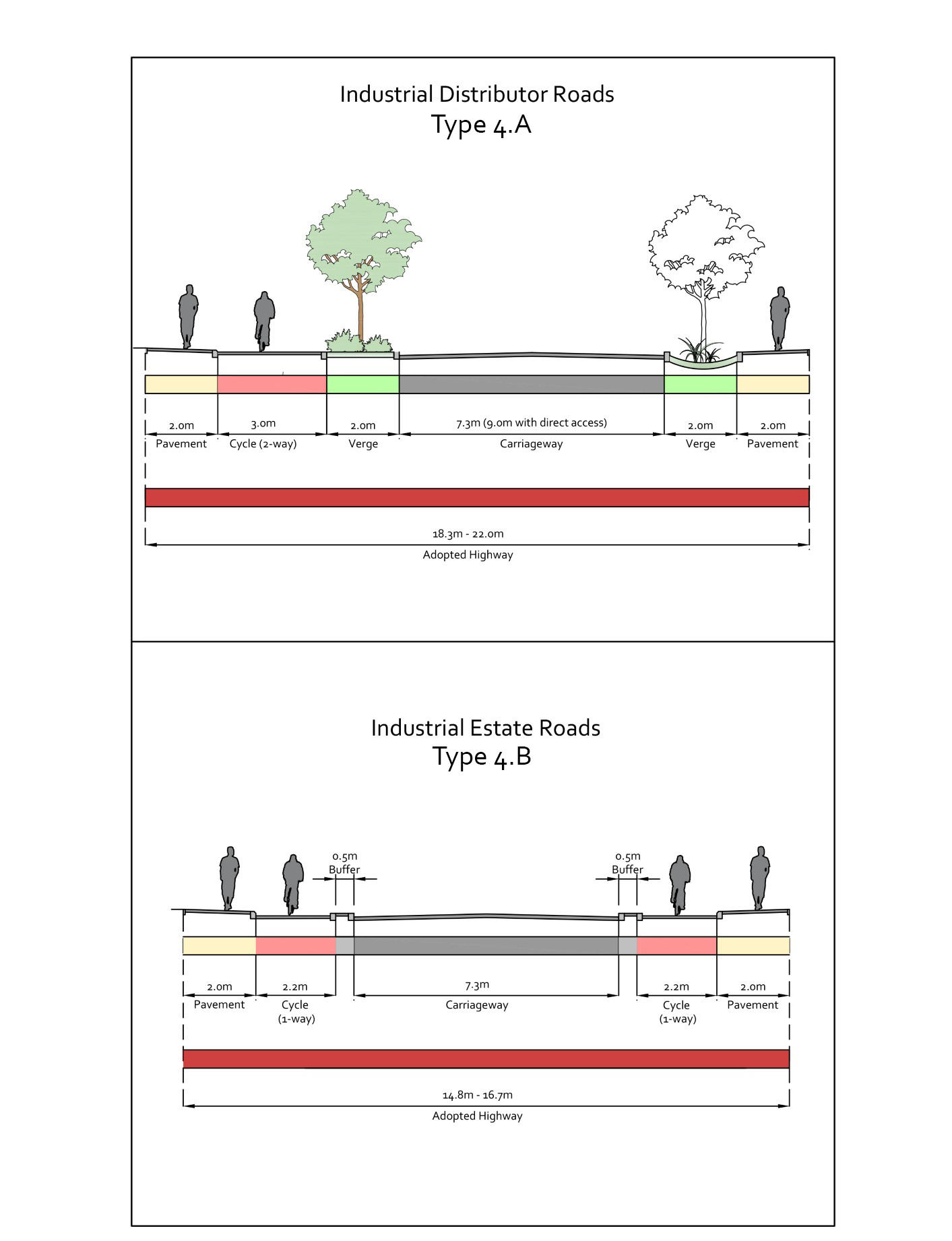
Type 4.A Industrial Distributor
These roads are only to be used on industrial estates. They should allow for walking, wheeling and cycling, as well as public transport, as they are likely to be used by travelling to work, including those without a car. Cycle lanes are required, as these streets are likely to carry higher levels of heavy goods vehicles. The distributor roads provide the spine of an industrial estate, connecting it to the wider road network. The width of the road will depend on whether industrial units have access directly from the road. They should include verges which can be used for tree planting or SuDS.
Type 4.B Industrial Estate
Estate roads connect industrial units to the distributor roads, or to the trunk road network. They should allow for walking, wheeling and cycling, as well as public transport, as they are likely to be used by travelling to work, including those without a car. Cycle lanes are required, as these streets are likely to carry higher levels of heavy goods vehicles. As an indication, Industrial Estate Roads are expected to accommodate up to 250 movements per day by vehicles of 1.5 tonnes or greater.